AVENTURE, ADVENTURE
| FRANCAIS | ENGLISH | |
Cette page est
destinée à vous expliquer en détail l'itinéraire que Patricia a choisi pour
ses ascensions.
|
This page is aimed at giving details about the ititnerary Patricia defined for her ascensions. | |
| Vous y retrouverez aussi toutes les informations sur les aspects techniques de l'ascension. Par exemple, comment s'organiser pour ne pas manquer d'eau, les particularités géologiques qui influent sur le déroulement de l'ascension. | You'll find here as well all the information about the technical aspects of the ascension. For instance, how to get set and not lack water, the geological specificities influencing the proceedings of the ascension. | |
| Ci-dessous: - un tableau détaillé en 3 parties de l'itinéraire, où vous pourrez découvrir les splendeurs de chaque étapes et que vous pouvez télécharger dans son intégralité. - une carte de l'itinéraire - un tableau des distances entre les différentes haltes ou villages au sein des monts Simiens. - un lien pour télécharger les cartes topographiques et les images satellites. |
Below: - a detailed 3-part table of the itinerary, where you can discover the magnificence of each steps. You can download the entire doc in PDF format. - the map of the itinerary - a table of distances between the different points or villages within the Semien mountains. - a link where you can download the topgraphic maps and the satelitte images. |
|
Itinéraire en 8 images - Itinerary in 8 images   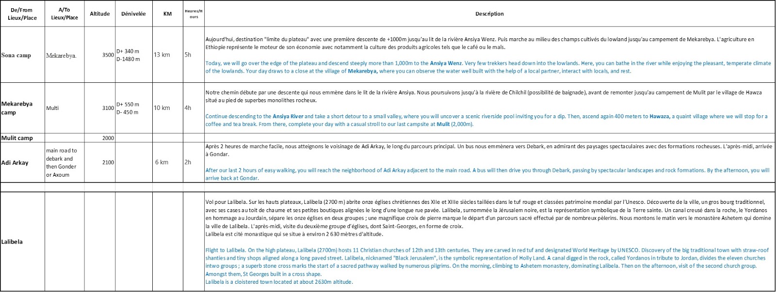     Vous pouvez télécharger le fichier PDF ICI - You can download the PDF file HERE. |

On this link, you can download a PDF file with all the topographic and satellite images of Simien mountains.
 |
| L'itinéraire final - Final itinerary |


Commentaires
Enregistrer un commentaire